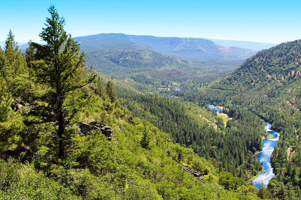
Stunning coastlines and snow-capped peaks are often the first images conjured when thinking of the Pacific Northwest, but the region is truly defined by its forests. Towering stands of firs, hemlocks and pines sustain salmon-filled rivers and provide habitats for wildlife found nowhere else on Earth. These forests — and the protections that have kept them standing for decades — are at a crossroads.
Land development and clearcut logging in the Pacific Northwest forests have devastated vast stretches of wildlife habitat. Since European settlement, an estimated 72% of old-growth conifer forests have been lost. These forested habitats are critical ecosystems. Their dense tree canopy, decaying logs and rich understory provide an irreplaceable habitat for wildlife. For three decades now, wildlife has benefited from protections from the foundational policy — known as the Northwest Forest Plan — guiding the management of nearly 20 million acres across 17 national forests across the Pacific Northwest region.
As the U.S. Forest Service looks to overhaul the Northwest Forest Plan for the first time since its adoption in 1994, there is concern the changes may remove protections for stands of mature forest, a key habitat. Defenders is committed to ensuring the plan’s habitat safeguards remain in place while it is modernized.
A Useful Tool
There are multiple ways to measure the anticipated consequences to wildlife from potential changes to the plan, such as assessing the acreage of impacted land or creating a map of the region. While both methods can be helpful, maps can prove much more useful than comparisons of raw numbers.
We can use maps to confirm where important areas overlap — a difficult task with numbers alone — by layering different types of information, like multiple threatened animal ranges and key habitats for example. Maps can also help identify spatial patterns and highlight specific areas where a policy change may be particularly impactful.
Maps are also powerful storytelling tools, which aid in communication as it is much easier to see the space represented rather than try to imagine it through a comparison of numbers. A series of maps can communicate the same information in just a few words and images that would otherwise require pages of complicated text.
Mapping the Impact
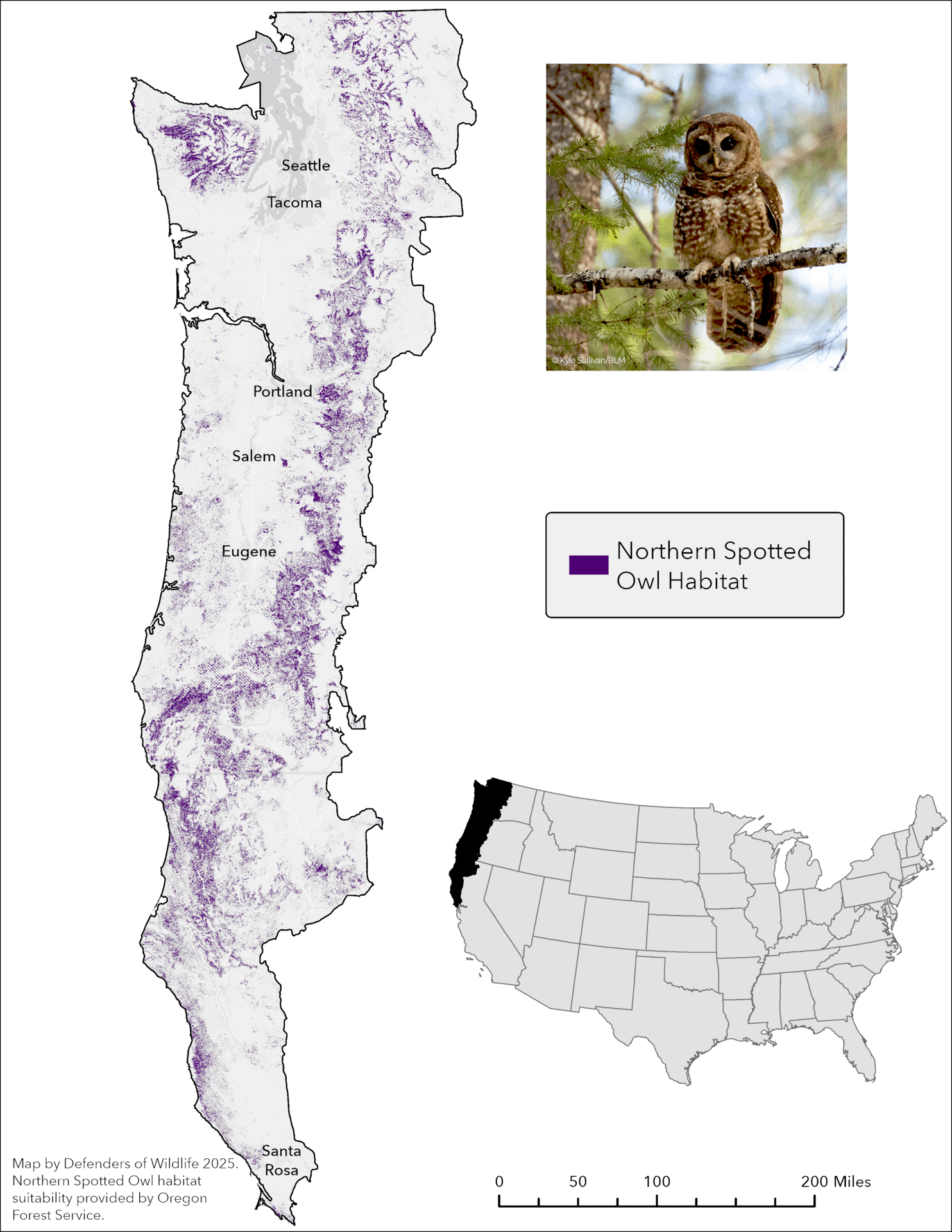
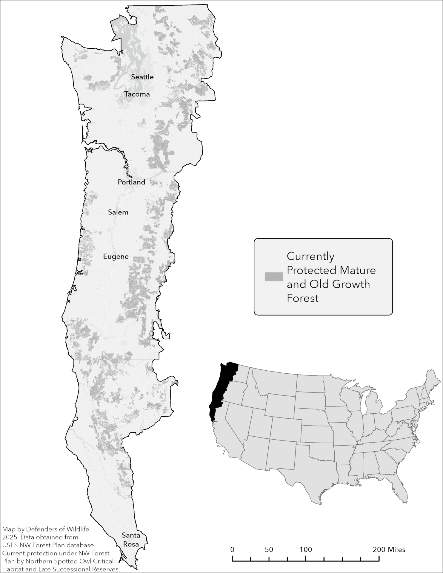
A prime example of the benefit of incorporating maps can be seen through Defenders’ assessment of the impacts of amending Northwest Forest Plan. Defenders set out to better understand these potential impacts by mapping old-growth habitat across the region and assessing how the proposed changes may affect at-risk species.
We first identified the areas where changes to the Northwest Forest Plan might affect forest habitat, which is largely dependent on the age classification of the forest.

We then examined the overlap of the U.S. Forest Service proposals with the home range of four forest dwelling species: the coastal marten, northern spotted owl, marbled murrelet and Pacific fisher. These animals depend on forested habitats for nesting, foraging and shelter. By protecting these key species, we can help safeguard the entire ecosystem and hundreds of other species depending on these mature and old-growth forests.
Finally, we brought it all together to visualize where older forest habitat overlaps with key wildlife reserves and regions.
Helping to Inform Decisions
As the process of amending the Northwest Forest Plan moves forward, these maps can serve as an important tool for policymakers, conservationists and the public to understand the stakes of these decisions.
At the same time, Defenders will continue to refine our analysis and advocate for science-driven policies that maintain the integrity of mature and old-growth forest ecosystems. Stay tuned as we share further insights and explore how these changes could shape the landscapes of the Pacific Northwest for generations to come. The future of the Pacific Northwest’s forests and the species calling them home depend on the choices we make today.
Author

Joseph Vaile


