Summer vacation is in full swing and many are hitting the road to explore safely. But people are not the only ones traveling this summer. Wildlife is also on the move, but not all species travel via wildlife corridors and land bridges. Many rely upon rivers and streams to travel great distances for safe nesting and spawning sites, warmer waters and plentiful food. However, across the country, dams for irrigation, power and flood control are blocking their pathways. Similar to how major roads and highways can block access to habitat for land animals, dams and diversions harm river connectivity, acting as physical barriers for wildlife. Dams also slow rivers down, allow invasive aquatic plants and non-native animals to thrive, increase water temperature and make riparian ecosystems and neighboring cities less resilient to climate change.

Defenders works across the country to address the harmful impacts of dams on wildlife, so in the spirit of summer, pack the car, grab some snacks for the way and put on your best sunglasses, it’s time for a road trip! Over 4,000 miles, our cross-country road trip from Florida to Washington will visit some of the places that Defenders is working to address dams and wildlife with stops in the Blue Ridge Mountains, the Gila River, the Yellowstone River and the Snake River.

Journey Begins: The Sunshine State
Our trip begins outside the town of Orange Springs, Florida, kitty-corner to the Ocala National Forest, where the threatened Florida manatee can be seen in the Ocklawaha River. Named the state aquatic mammal, manatees navigate among the rivers, estuaries and shallow coastal waters of Florida grazing on aquatic vegetation, and in the winter, they head to warm-water sources like springs to avoid cold stress. Identified as one of the country’s most endangered rivers, the Ocklawaha is a part of a major river system starting in the Green Swamp near Apopka and reaching to the Atlantic Ocean via the St. Johns River. It could serve as a major “highway” for manatees seeking warmer waters in the winter. But in 1968, the federal government constructed the Rodman Dam as part of the Cross Florida Barge Canal project, blocking the manatee’s access to the Ocklawaha’s 20 freshwater springs, including the iconic Silver Springs. The canal project was never finished, but the Rodman Dam remains and has caused fish biodiversity to decline from lost essential migratory pathways, degraded water quality and the flooding of 7,500 acres of forested wetland.

Defenders of Wildlife works with partners and stakeholders to bring heightened media attention to the benefits of river restoration. Additionally, we advocate for breaching the dam to restore the Ocklawaha River’s natural flow and open up natural, warmwater habitat for hundreds of manatees.
Second Stop: Oldest Mountain Range
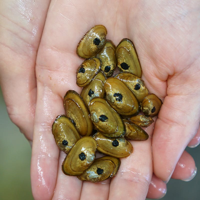
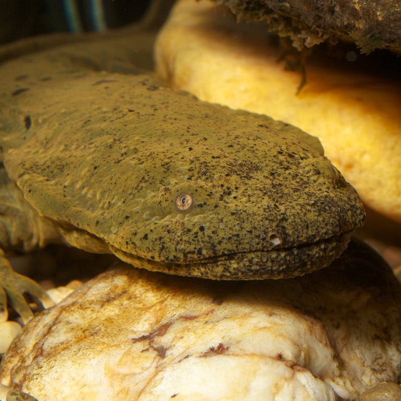
Back to the car, it’s time to take I-95 N to the southern Appalachian's Pisgah National Forest in North Carolina. The oldest mountain range in the U.S., the Appalachians are home to a great diversity of aquatic wildlife including freshwater mussels, aquatic plants and freshwater fish. One of the most remarkable watery residents is the river chub, an ecosystem engineer, whose nest-building creates habitat for other aquatic species.
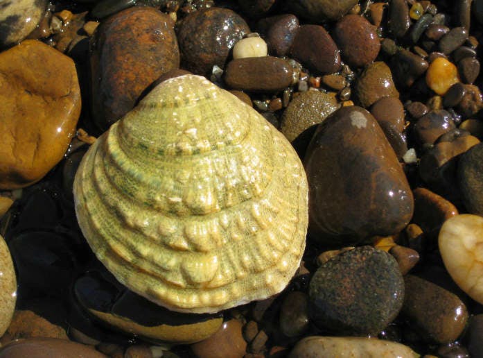
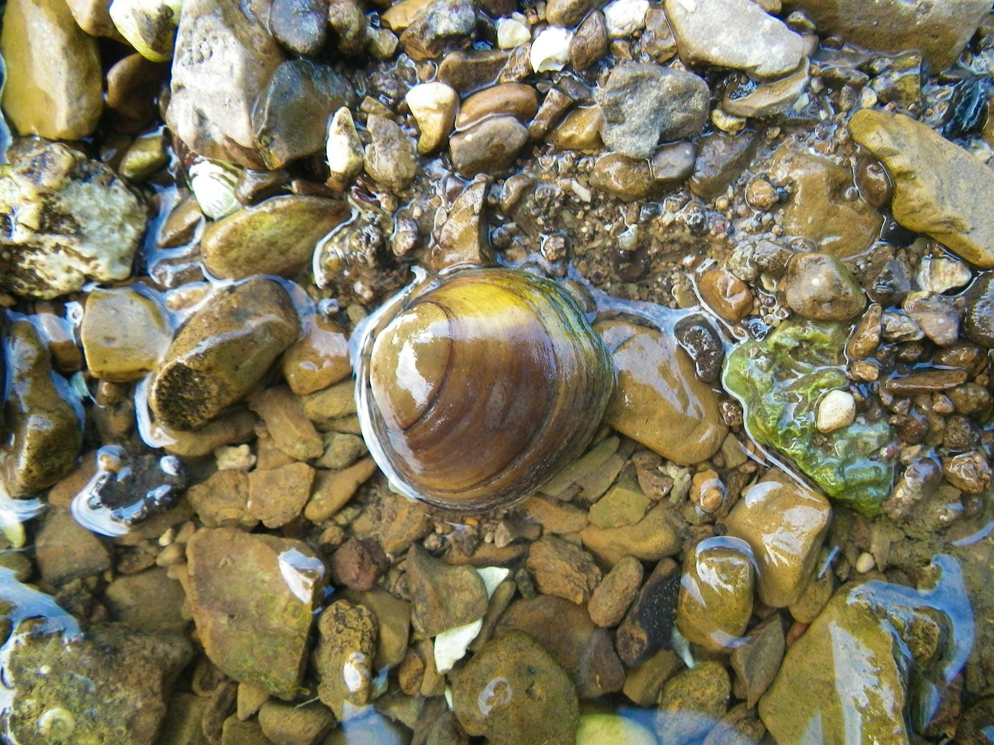
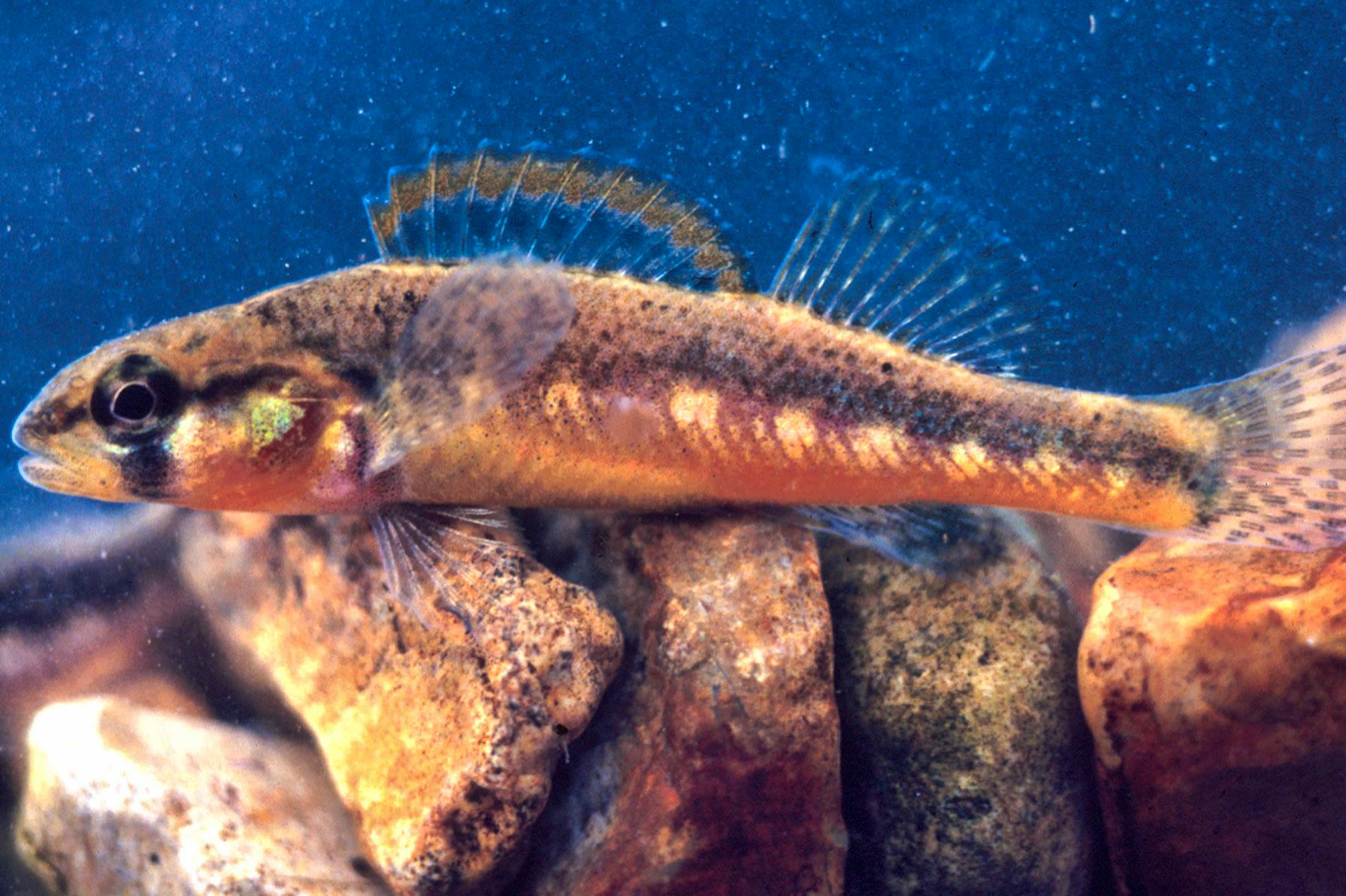
Large dams constructed for irrigation and flood management have drastically altered the landscape of the region, impounding once free-flowing rivers that, starved of oxygen, can no longer support populations of many sensitive fish and mussel species. And hundreds of smaller dams called “low head” dams—installed to service farms and grist mills over a century ago—harm the connectivity of this highly biodiverse region, change water flow and increase water temperatures. These dams and their reservoirs threaten the reproductive ability of many native freshwater species—like the river chub—and they make it more difficult for these species to adapt to a future influenced by climate change.

Defenders of Wildlife is fighting to protect private, state and federal habitat throughout the southern Appalachians, from privately owned farmland across the region to Tennessee’s Rocky Fork State Park to the Pisgah and Nantahala national forests. We have developed the Southeastern Hellbender Conservation Initiative to help farmers improve habitat for hellbenders and the other species that share their habitat by restoring water quality and removing in-stream barriers to passage on their farms. We serve on the steering committee of the Tennessee River Basin Network, a large collaborative partnership aimed at protecting water quality and habitat in one of the most biologically diverse river basins on Earth. Defenders also plays a leadership role on several coalitions and partnerships throughout the Southeast to protect and restore the health of streams and rivers for all freshwater wildlife, including the 14-state Wetland Forest Initiative and the Little Tennessee River Native Fish Conservation Partnership.
Third Stop: The Land of Enchantment
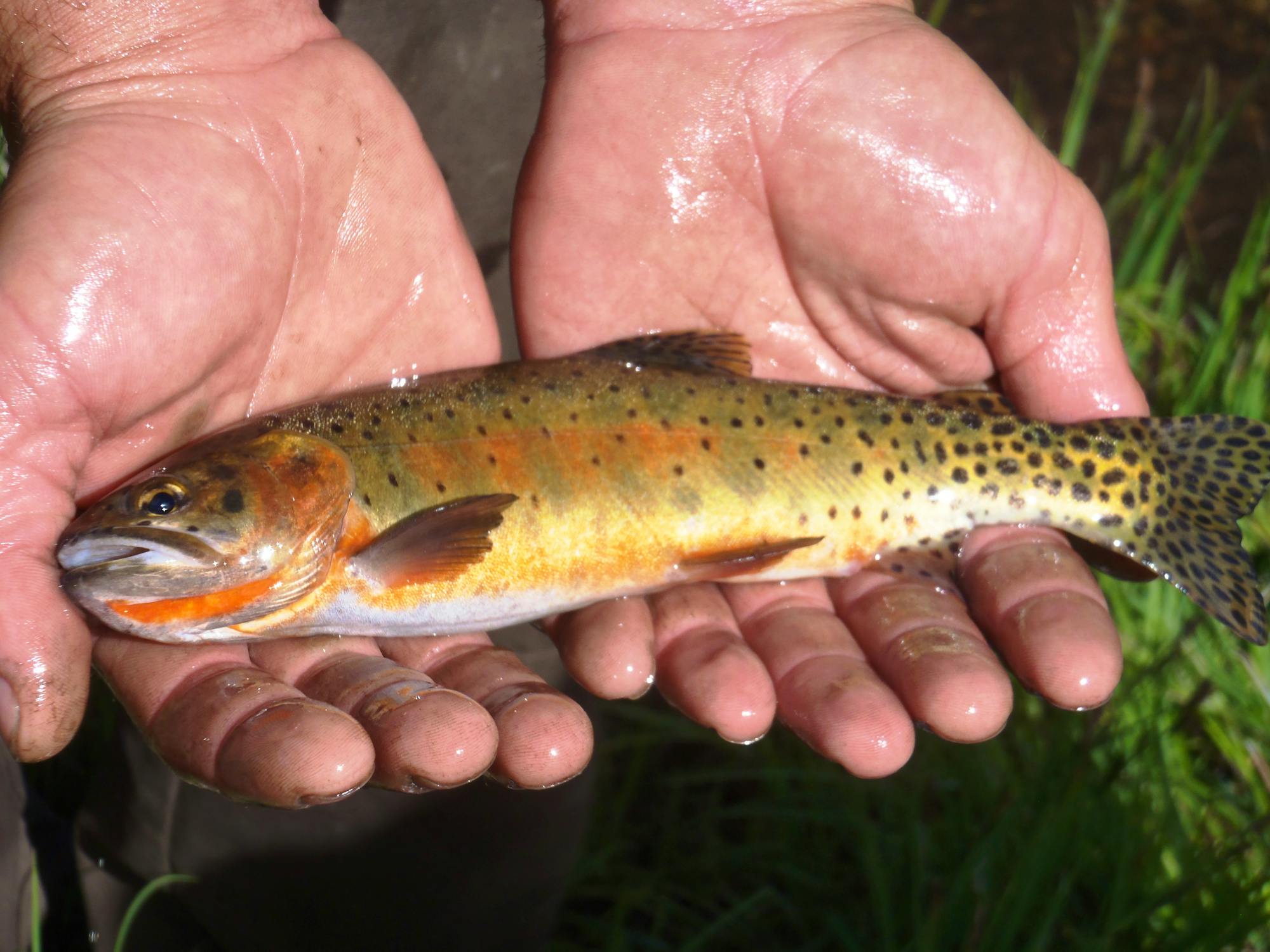
Next, we’re headed across the country to New Mexico! (On your way through Ozark National Forest, take a break to look for hellbenders because it’s a 30-hour drive!). The first river to visit here is the Rio Grande. On the upper portions of the river, Defenders is working to protect freshwater fish, like the Rio Grande cutthroat trout (New Mexico’s state fish), by participating in a reintroduction and release project to restore the species to native habitat. On a smaller level, Defenders is also leading the effort to better understand aquatic connectivity through a grant from New Mexico Department of Game and Fish to survey how road infrastructure is impacting passage of native species like Rio Grande chub and Rio Grande sucker.
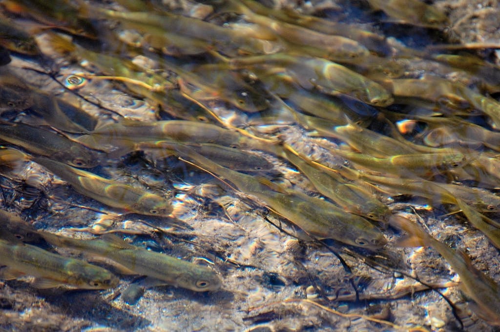
The Middle Rio Grande, in central New Mexico, where dozens of dams and irrigation canals have greatly disrupted wildlife and decreased diversity, Defenders is working to restore a more natural water flow and healthy ecosystem. The dams and canals have channelized the river’s course and prevented the seasonal flooding that riparian wildlife and vegetation evolved alongside, permanently altering its ecology. By partnering with water users in the Rio Grande Valley, Defenders is protecting fish like the Rio Grande silvery minnow.

A little over 100 miles west lies the Gila River, a biodiversity hotspot for freshwater fish, aquatic plants and riparian life. Seven federally listed species live in the Gila River basin, including the loach minnow, spiked dace, Gila chub and Gila trout. For the past 15 years, the threat of a diversion dam has united support for protecting New Mexico’s last free-flowing river, but thanks to that grassroots and community support, the proposal is off the table!

These two rivers once shared similar biodiversity, but the dams have diminished the Rio Grande’s ability to support uniquely evolved species. Although many of the species of the Gila are federally listed, they continue to occupy historical habitat whereas on the Rio Grande, many native fish species have gone extinct because of dams and unnatural water-management regimes.
Fourth Stop: Western Wonderland
Time to head north along I-15 to Yellowstone National Park and Wyoming. Don’t forget your camera to capture the great canyon lands of the Southwest on the drive. The great Yellowstone River is home to an ancient “dinosaur” fish, the pallid sturgeon. Once freely swimming thousands of stream miles from nesting sites in Montana to New Orleans, endangered pallid sturgeon are threatened by warming river temperatures and for decades have been blocked by dams from successfully reproducing in the wild by barring access to historical nesting sites.

Through a combination of stakeholder outreach and legal action, Defenders is trying to protect free-flowing rivers for the mighty pallid sturgeon. Defenders’ legal intervention initially prevented the Army Corps of Engineers and Bureau of Reclamation from building a large concrete dam across the lower Yellowstone River at Intake, Montana, to replace a smaller rock structure used for irrigation.Though the injunction was overturned in 2018, Defenders continues to monitor the project, and the sturgeon population, with the hope that positive opportunities will exist in the future to again intervene on behalf of pallid sturgeon recovery.
Final Stop: Shining Sea
For the final leg of the journey, it’s time to take I-90 W to two of Washington’s great rivers, the Snake River and the Chehalis River. In the late 60s early 70s, a series of dams were constructed on the lower Snake River to help transport agricultural goods and generate hydropower. Contentious at the time of construction, the dams still remain the subject of numerous legal challenges. At the center of this controversy is salmon, a fish important to the local economy, native peoples and a crucial part of the endangered southern resident orca’s diet. Because of dams, the Snake River regularly reaches temperatures that are lethal to salmon, which violate the state clean water regulations. Climate change will further exacerbate this warming, making dam removal essential for Snake River salmon’s survival. Defenders also advocates for the removal of dams in the Pacific Northwest because their impacts on salmon puts the survival of southern resident orcas in doubt.

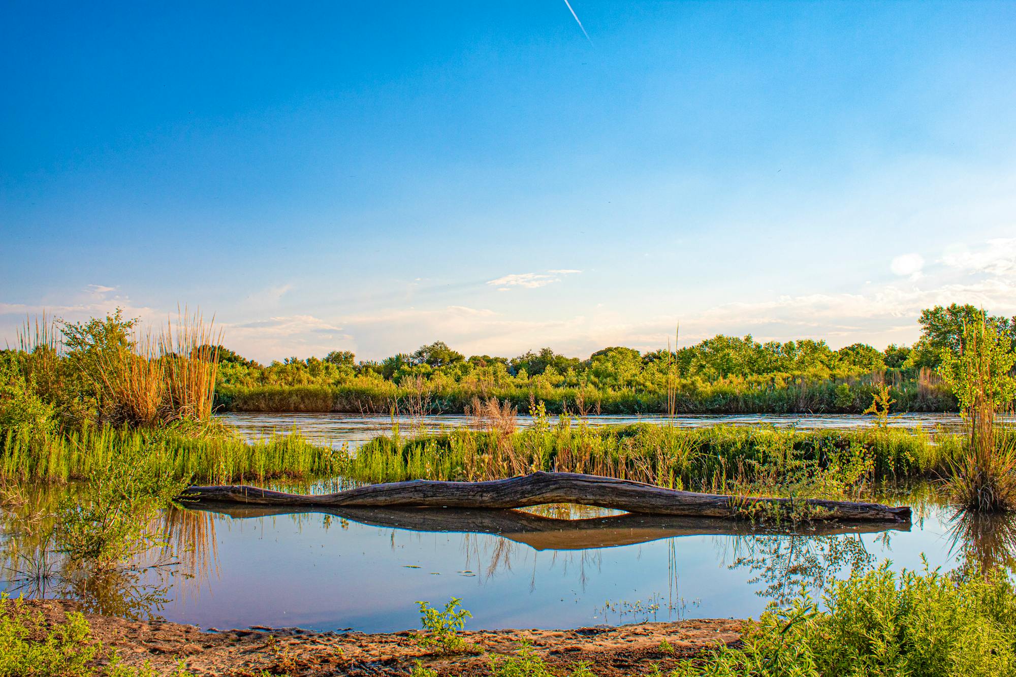
West of the Snake River lies the Chehalis River, an important river in southwestern Washington that empties into Gray’s Harbor. Flooding in recent years has prompted cities along the river to discuss the possibility of constructing a dam for flood management. Scientists and the government’s environmental impact statement agree that a dam would be an ineffective long-term solution and it would harm fish populations as well as make the community more vulnerable to floods in the distant future. Additionally, the dam is opposed by the Quinault Nation, one of the river’s comanagers. Defenders of Wildlife stands with the Quinault Nation and other local stakeholders to advocate for investing in reforestation and flood plain restoration instead, which would decrease the chances of devastating floods and improve climate change resilience. Recently, Gov. Inslee directed the state to develop nondam solutions to flooding.

Thank you for joining us on our cross-country road trip for World Water Week. And let’s remember that all roads lead to Rome, and all rivers flow to the sea. These familiar adages describe a fundamental reality for aquatic wildlife that use rivers like great highways—unless they encounter dams that act like roadblocks in their watery world.